LATEST UPDATE:8 September 2009 - Greenland & Canada.
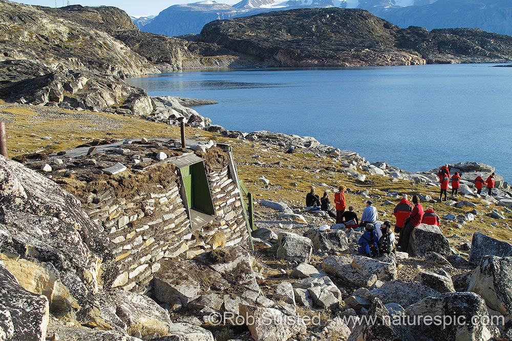
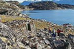
We got to Nuuk, the captial of Greenland. Of course Santa Claus is a tourist thing here, with his 'headquarters' in the tourist office. The national museum was worth the visit. On display are 4 of the famous perfectly preserved Greenland Qilakitsoq Mummies from around 1475AD. Several days later we were to visit Qilakitsoq, the actual burial site, just across from Uummannaq town. Uummannaq is very scenic, and the recent wind had choked the harbour with large icebergs enhanced the view. Lunch was served with a collection of local foods - esp. fin whale meat and much dried fish at the local hotel. Afterwards we hiked over the island for an hour to a back bay where Santa Claus has his summer house. He wasn't in when we arrived , but Christian one of our team (with authentic white beard) was on hand to pass out sweeties! The traditional turf house was furnished with his belongings. And yes Janette (my able bodied Business Manager), I did leave a note for you saying you'd been good.
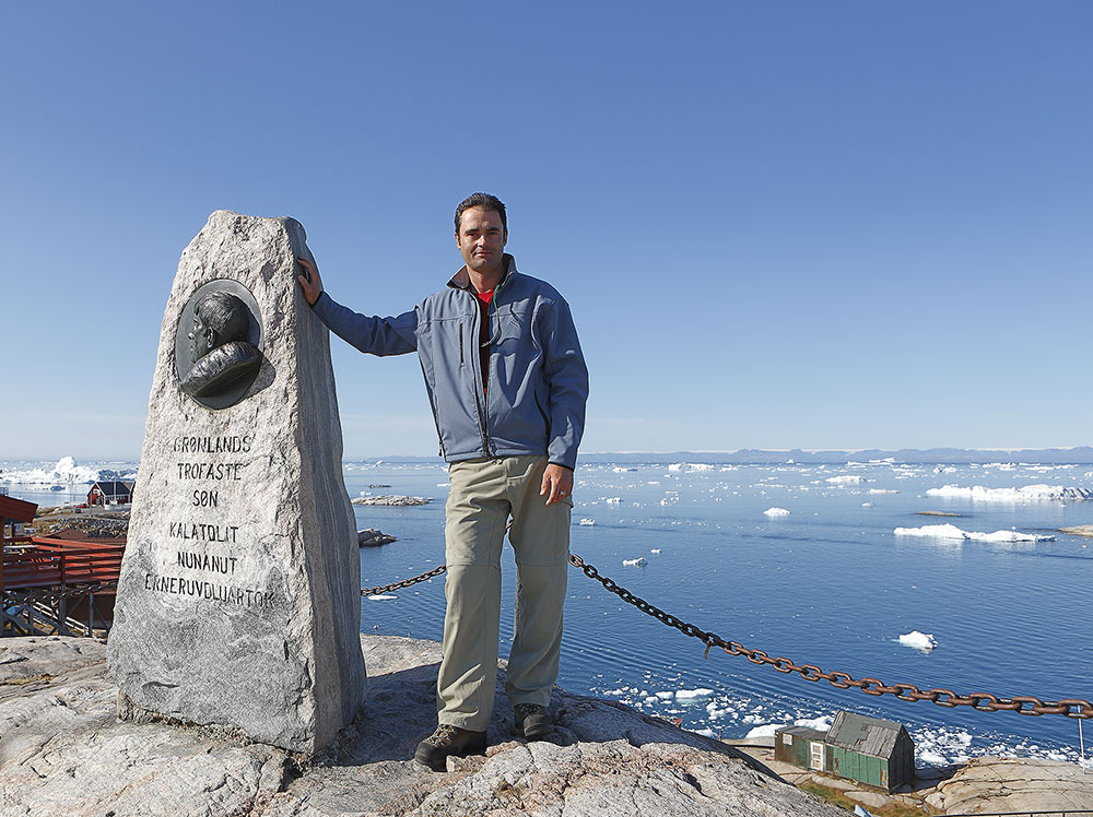
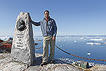
Ilulissat - now that's a spectacular place in Disko Bay. Jacobshaven Glacier has the highest output of water (ice) in the northern hemisphere. It's calving more ice in one day than New York uses in water in one year apparently. The huge bergs take 2 years to travel down the fiord and out past the town. It is truly impressive, and little wonder why this is the heart of Greenland tourism, and also a UNESCO World Heritage site. It produces very tall bergs as they roll around in the fiord, and these litter Disko Bay and the surrounding Davis Strait. We had 2 days there, seeing a fantastic sunset on departure, humpback whales amongst the bergs and generally just staring in awe from the various hiking tracks at the scale of things.
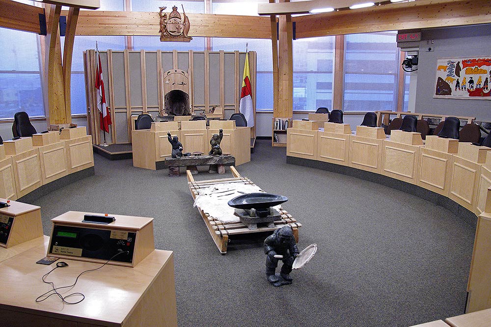
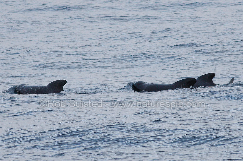
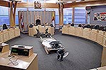
Next was the Davis Strait passage across to Baffin Island in the Canadian Arctic. We spotted a hundred or so Pilot whales, but within sight of our first landfall, a tiny lonely piece of ice floated past with 2 polar bears eating a seal, 20NM from land. Welcome to Canada! We called at Iqaluit, the capital of Nunavut. Had a look in the Government's Legislative Chamber which was festooned with indigenous icons, art, narwhal tusks and meaning. I enjoyed seeing this, and the strong connection still with nature, the environment and the strengthening culture.
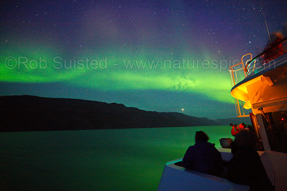
Then across to Lower Savage Islands to drive zodiacs amongst them looking for Polar bears. The first bear literally popped up in rocks about 30 metres from the Zodiac I was driving. Fantastic! Sadly, in Canada, (unlike Svalbard) Polar bears are hunted, have a great fear of humans, and generally high tail it quickly. But, we saw another 11 polar bears before heading to Resolution Island and spotting another two. 13 polar bears in one day and the Aurora borealis (Northern Lights) playing overhead to end with - what a day!!
Then a visit to Lady Franklin and Monumental Islands (both names connected to the famous missing Franklin Expedition in the North West Passage). Had another few polar bear sightings before the largest one I have ever seen decided to lie and/or prance on a rock very close to the coastline with very little concern (wee below right). This was a highlight. A visit to Akpatok Island was curtailed due to high winds, but I spotted a lonely bear walking the cliff top about 800 feet above us.
This morning we called into Hopedale, a tiny mostly Inuit town of 600 in Labrador. A beaut setting and historic place with Moravian church and Mission arriving from Germany in 1782 and being possibly the oldest building in east Canada. The local kids were out in force and we spent the morning giving them joyrides in the zodiacs around the ship. We were the first outside ship to call here this year and the smiles on their faces said it all. The kids certainly made the visit enjoyable for all of us.
|
|
|
Leaving Ilulissat IceFjord, Greenland, at dusk!
|
|
|
|
|
|
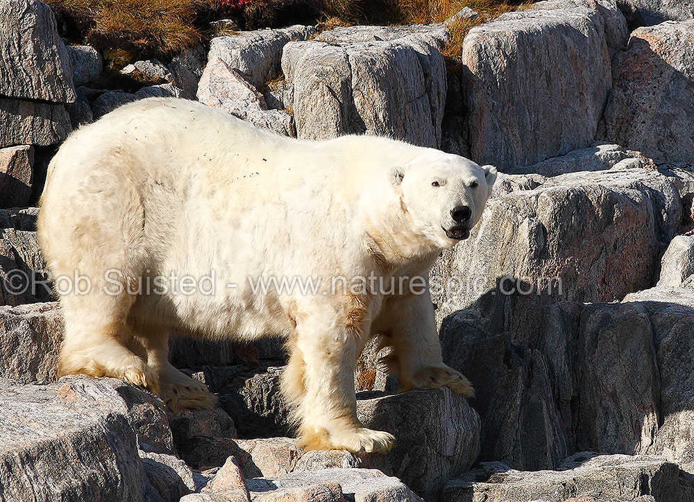
Very large Polar Bear on Monumental Island, Canadian Arctic
|
|
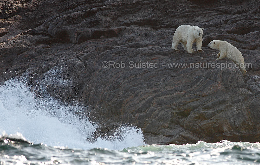
Polar Bear mother and cub on Lady Franklin Island, Canadian Arctic.
|
|
|
|
|
|
Aurora borealis, Northern Lights, Greenland
|
|
|
|
Humpback whales amongst ice
|
|
|
|
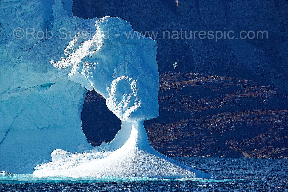
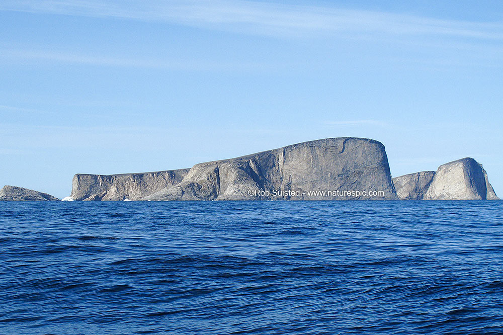
Iceberg near Uummannaq, Disko
Bay, Greenland
|
 |
|
Santa's summer house, Uummannaq,
Greenland
|
 |
|
Rob at Ilulissat, Greenland
|
 |
|
Nunavut legislative chamber, Canada
|
 |
|
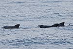
Long finned Pilot whales at sea
|
 |
|
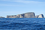
Lady Franklin Island, Canadian Arctic
|
|